
In the previous blog we told you why it is important to migrate from geometric network to utility network while in this blog we shall support our customers to give them an idea of how we migrate their geometric network data to the utility network to help them in their business and the steps involved in it.
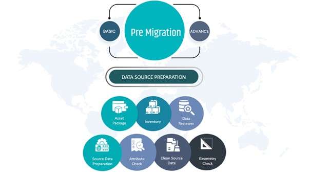
The Pre migration process is one challenging task when it comes to migrating from geometric network to the utility network. The Data reviewer helps to identify the problematic data and helps clean accordingly.
The attribute checks, geometry checks, duplicate lines help to ensure that there is no slack network while transferring the geometric network geodatabase to Utility Network.
Once the preparation is done, the risks are mitigated and the datasets are staged, we start migrating the data. The geometric network database with the help of ArcGIS Data Interoperability Extension focuses on Source or Target Schema Mapping which has Asset Group/Asset Type, Attributes, utility (water/wastewater, gas, telecom etc.) and is one of the tedious processes of migration which is then updated from Point to source data.
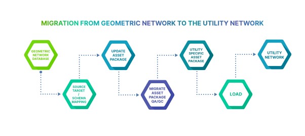
The Migrated Asset Package undergoes Quality Assurance and Quality checks where the Python script is also proofread and validated.
The branch versioning enables multiuser editing and transactions via feature services in utility networks. The migrated geometric network database is then loaded as a utility network.
Hexamap follows best practices while migrating from geometric network database to the utility network. The single Annotation Feature class uses the asset package where we calculate the new Object Id from the base feature class to the annotation feature class and make new Global IDs.
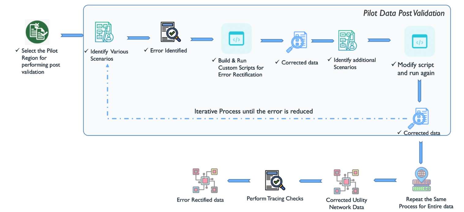
After the data migration is done a plot region is selected for performing post validation upon which several scenarios with errors are identified and the custom script is built and run for error rectification. The same process is repeated for every data available.
Senthil Kumar V is a seasoned Senior Pre-Sales Consultant with over 8 years of expertise in the geospatial field. He brings a wealth of technical proficiency, specializing in GIS, spatial analysis, and remote sensing. His dedication to innovation and effective communication ensures successful client solutions, making him an invaluable asset to our team.
Nimisha Srivastava is a Pre-Sales Consultant who is enthusiastic about the Geospatial field and has great communication skill. She has an year’s experience in the geospatial industry and is always eager to learn new things.