GIS in Land Valuation System

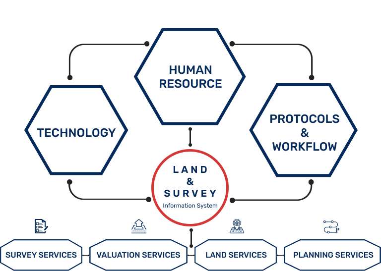
Efficient Land Valuation and Acquisition Management System.

OVERVIEW

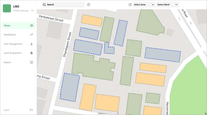
GIS-based land valuation and acquisition management involves process like identifying suitable land parcels for acquisition, determining their market value, managing the acquisition process, and assessing potential environmental impacts of land use changes. GIS technology enables users to map, analyze, and visualize data related to land ownership, land use, and other relevant factors, making the process more efficient and effective. GIS-based land valuation and acquisition management is a valuable tool for managing the complex process of land acquisition and development.

USES OF GIS IN Land Valuation System

WHAT HEXAMAP OFFERS IN Land Valuation System

Land Acquisition Process Monitoring

Spatial Analysis

Enterprise GIS Solution Deployment

Land/Asset Valuation

Customized Dashboards & Reports

Integration with Sub Systems

GIS IN Land Valuation System

BENEFITS OF GIS BASED LAND VALUATION AND ACQUISTION MANAGEMENT SYSTEM

  • Efficient data management by collecting and analyzing large amounts of land data.
  • Creation of accurate and detailed maps that help in identifying areas of interest, track changes in land use and plan future development projects.
  • Assess the land value based on various land valuation approaches.
  • Informed decision-making through data analysis of factors such as population growth, environmental conditions, and infrastructure availability.
  • Effective communication with stakeholders and the public through interactive maps providing relevant information on land ownership, zoning, and other aspects.
  • Streamlined processes such as property valuation, land surveying, and land-use planning, saving time and resources.