GIS in INDOOR

Smart Indoor Management for Business optimization

OVERVIEW

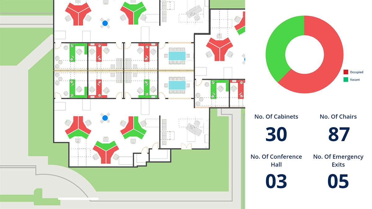
Indoor mapping system enables smart building management by integrating computer-aided design (CAD), building information modeling (BIM), site scans, and operational datasets into floor-aware indoor maps. It supports facilities, workplace operations, maintenance applications, 3D representation of building with multiple Level of Detail(LOD).

GIS IS USED THROUGH OUT THE CYCLE OF indoor PROJECT

Indoor Space Management

Facility management

Asset management

Smart Building Management

Operation & Maintenance

GIS in Indoor

WHAT HEXAMAP PROVIDES FOR GIS IN INDOOR

Enterprise GIS Solution Deployment

Data Cleanup & Conversion

Data Migration

Dashboards & Reporting

Mobile Application for tracking assets

Integration with BMS and other systems

BENEFITS OF GIS in INDOOR

  • Efficient resource allocation and management
  • Better informed decisions with indoor analytics
  • Seamless connection to Indoor routing services.
  • Act as common operating platform.