Enabling Agriculture Sector with increased productivity and Monitoring
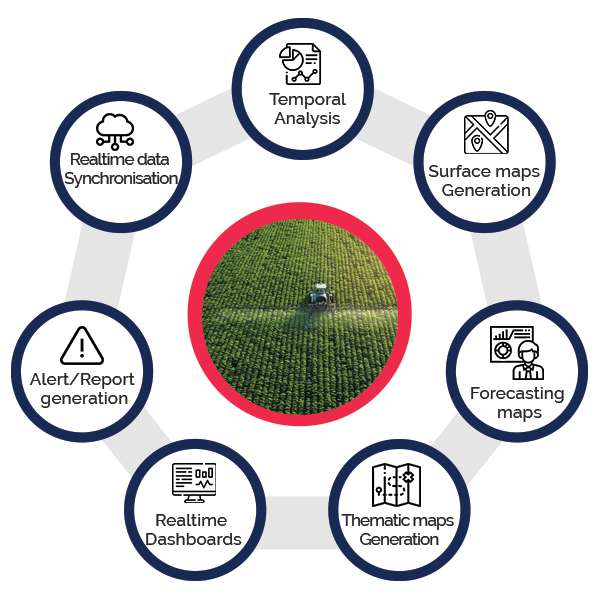
GIS in agriculture helps farmers to achieve improved production and reduced costs by enabling better management of land resources. GIS integrates with smart sensors, allowing decision makers to overlook all the farmlands with their allied information and current situation. Using Satellite data, GIS can perform Image Analysis, Image classification, NDVI, temporal change analysis and other spatial analysis. Using GIS, we can view and analyze the near real time data, archived data, forecast data, alert info based on integration with the IOT Sensors and other system..