GIS in Water

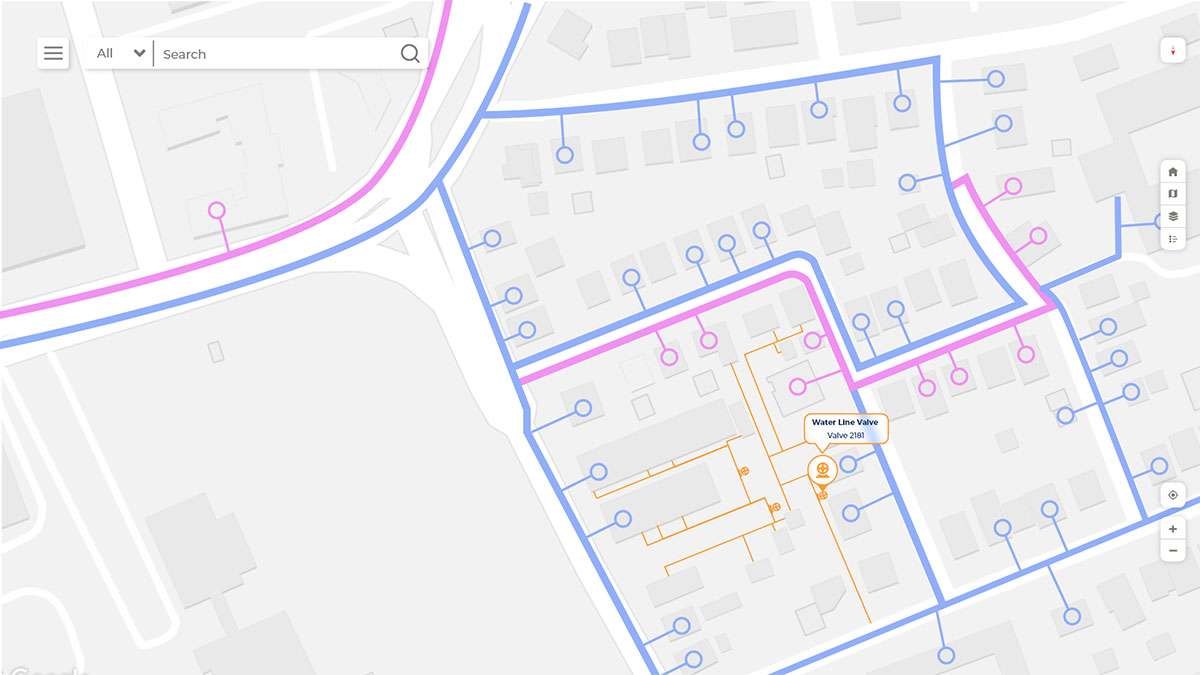
Intelligent Water pipeline Management with GIS

OVERVIEW

With integration of GIS, the organizing of data for the water distribution networks design, analysis and network management is simplified. GIS can contribute to decision making, damage control and planning for valve closing and opening, pipe break, service area managements. GIS empowers water networks with modern data model, out-of-the-box analytics tools, and easy-to-use maps, simplifying day-to-day operations.

GIS IS USED THROUGH OUT THE CYCLE OF water PROJECT

Storage and management of geospatial data

Water Network management and Planning

Asset management

Operational Intelligence

Outage Management

GIS in Water utility

WHAT HEXAMAP PROVIDES FOR GIS IN WATER utility

Enterprise GIS Solution Deployment

GIS Desktop Customization

Data Migration

Dashboards & Reporting

Mobile & Web Application for O&M

Integration with SCADA and other sub systems

BENEFITS OF GIS IN WATER UTILITIES

  • Plan route to ensure maximum reach with minimum length
  • Reduce the network design time
  • Identification of weak pipeline section and leakage management
  • Integrated system for managing the water assets.