Construction Progress

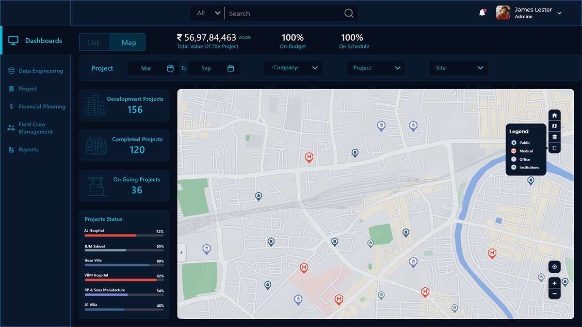
Enhancing Construction Productivity with Visual Intelligence.

OVERVIEW

Geospatial Data Analysis enables to understand and monitor construction progress and to ensure that project strictly adheres to construction timelines & budgets. The construction industry would benefit from innovative solutions for operational efficiency, productivity improvement, and real-time progress monitoring based on actual site conditions by adopting to Geospatial management.

GIS IS USED THROUGH OUT THE CYCLE OF construction PROJECT

Drone based surveillance

Accident Analysis

Construction Progress

Work force Management

Operation & Maintenance

Construction – Enhancing Construction Productivity with Visual & Geospatial Intelligence

WHAT HEXAMAP PROVIDES FOR CONSTRUCTION PROGRESS

Enterprise GIS Solution Deployment

GIS Desktop Customization

Data Migration

Dashboards & Reporting

Mobile Application for Inspection

Integrations with other sub systems

BENEFITS OF GIS IN CONSTRUCTION PROGRESS

  • Immediate detection of deviations and a considerable reduction in the cost of reworks.
  • Saves project progress monitoring time.
  • Reduces manpower requirements and project cost.
  • Ensure sufficient stocks maintained for unhindered project progress.