
In today’s fast-paced digital landscape, mobile GIS applications have become indispensable for organizations that rely on field data. By bridging the gap between the field and office, the Mobile GIS applications empower teams to make accurate, real-time business decisions while improving collaboration and operational efficiency.
Esri, a global leader in geographic information system (GIS) technology, offers a wide range of mobile GIS applications tailored to support field activities such as data collection, inspection, tracking and analysis.
Mobile GIS applications enable field personnel to capture, store, update, delete, manipulate, analyze and visualize geospatial data on the go. This reduces redundancy, streamlines workflows, and ensures that data is available in real time for more informed decision-making.
Organizations across industries face challenges such as:
Esri addresses these challenges through three categories of mobile GIS solutions:
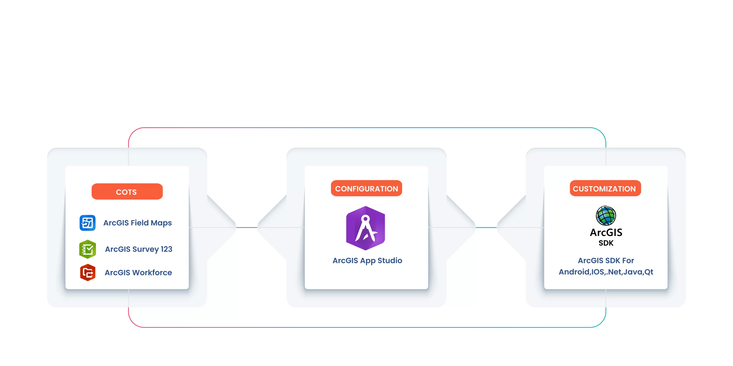
Commercial Off-The-Shelf (COTS) mobile applications from Esri provide ready-to-use tools for field operations. These apps are widely adopted across various industries due to their ease of deployment, rich functionality and seamless integration with the ArcGIS platform.
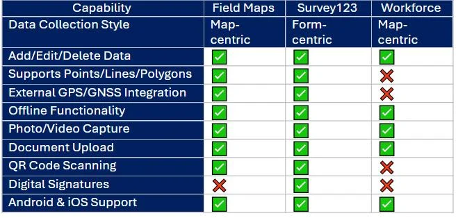
Key Applications:

Feature Comparison:
Using AppStudio for ArcGIS, organizations can build mobile apps with minimal coding by leveraging a suite of pre-designed templates. These apps can be configured from maps, scenes, or groups and offer a streamlined development process from design to deployment.
Key Benefits:
For organizations with unique workflows and requirements, Esri provides a variety of Software Development Kits (SDKs) that allow full customization of mobile apps from the ground up.
Available SDKs:
These SDKs provide complete control over the app’s features, user interface, data processing logic and integration with external systems and sensors
CONCLUSION
Mobile GIS applications powered by Esri technologies are revolutionizing the way organizations operate in the field. Whether you need a plug-and-play solution, a configurable app tailored to your needs, or a fully custom-built platform, Esri provides the tools to enhance field productivity, streamline operations and improve decision-making through location intelligence.
Nimisha Srivastava is a Pre-Sales Consultant who is enthusiastic about the Geospatial field and has great communication skill. She has an year’s experience in the geospatial industry and is always eager to learn new things.

