
Real-Time Geospatial Intelligence
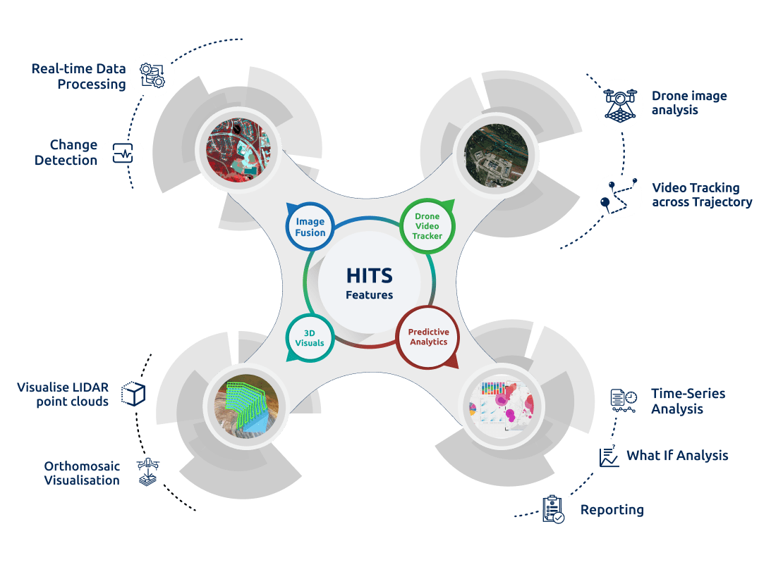
Hexa Image Insights (HITS) is a powerful web-enabled platform designed for comprehensive image-based analysis. It revolutionizes the way industries interpret and utilize spatial data by seamlessly integrating drone image analysis, satellite data, and advanced GIS technologies. With real-time data processing capabilities and enhanced image server performance, HITS offers professionals a high-precision, bird’s-eye view of their project areas.
Engineered for industries where timely and precise data is critical—such as agriculture, forestry, defence, disaster management, and infrastructure development—HITS ensures informed decision-making through clarity, depth, and spatial accuracy.
Perform rich, contextual interpretations using high-resolution aerial imagery and historical datasets—all within a unified web platform.
Conduct complex geospatial assessments tailored to your field of work, including vegetation health monitoring, infrastructure progress tracking, and disaster response planning.
Integrate UAV-captured imagery into your workflows, allowing for precise temporal comparisons and object-level insights.
Make time-sensitive decisions with up to date, on-the-fly image computations, ensuring minimal delay in operations.
Efficiently handle and process large-scale imagery with superior speed and accuracy using our optimized backend.
Unlock the full potential of geospatial imagery through intuitive tools designed to maximize data accuracy, project efficiency, and decision-making confidence. HITS simplifies your analytical journey—whether you’re processing drone images, evaluating agricultural health, or managing emergency response.
Experience how Hexa Image Insights (HITS) can transform your spatial data workflows with real-time drone image analysis, enhanced processing power, and actionable insights.
Book a personalized demo today and discover the power of comprehensive image-based analysis at your fingertips.

