The integration of Building Information Modeling (BIM) with GIS is revolutionizing the architecture, engineering, and construction (AEC) industry. By combining these two powerful technologies, design and construction companies can access accurate data, streamline project management, and improve decision-making. The synergy between BIM and GIS provides a comprehensive platform that enhances collaboration and efficiency across all project stakeholders.
In today’s rapidly evolving Architecture, Engineering, and Construction (AEC) industry, two powerful technologies—Building Information Modeling (BIM) and Geographic Information Systems (GIS)—are transforming the way projects are planned, designed, and managed. While both serve distinct purposes, their integration creates a comprehensive, data-driven approach to infrastructure development and urban planning.
Building Information Modeling (BIM) is a digital representation of a building’s physical and functional characteristics, widely used in the AEC industry for design coordination, clash detection, construction simulation, cost estimation, and facility management. Popular BIM software like Revit, Navisworks, Revizto, and BIM 360 facilitate seamless collaboration and accurate project execution. On the other hand, Geographic Information Systems (GIS) capture, store, analyze, and visualize spatial data, integrating location-based information with descriptive attributes. GIS provides valuable insights into geography, social economy, demographics, and environmental factors, enabling smarter decision-making in urban planning, infrastructure management, and disaster preparedness.
Integrating BIM and GIS can seem complex, but breaking it down into a systematic process makes it more manageable. The first step is data preparation, where data from both BIM and GIS systems is cleaned, formatted, and standardized to ensure compatibility and smooth exchange. Next is data integration, where the prepared data is merged into a unified platform using methods like point-to-point integration, middleware solutions, or cloud-based services. Once integrated, data analysis takes place, with GIS tools visualizing spatial data and BIM tools supporting simulations and structural analysis. This leads to decision-making, where insights from the analyzed data help in site selection, building design, and construction planning for more informed choices. Finally, data sharing ensures that the integrated information is accessible to project stakeholders, including owners, contractors, and regulatory agencies, fostering collaboration and transparency throughout the project lifecycle.
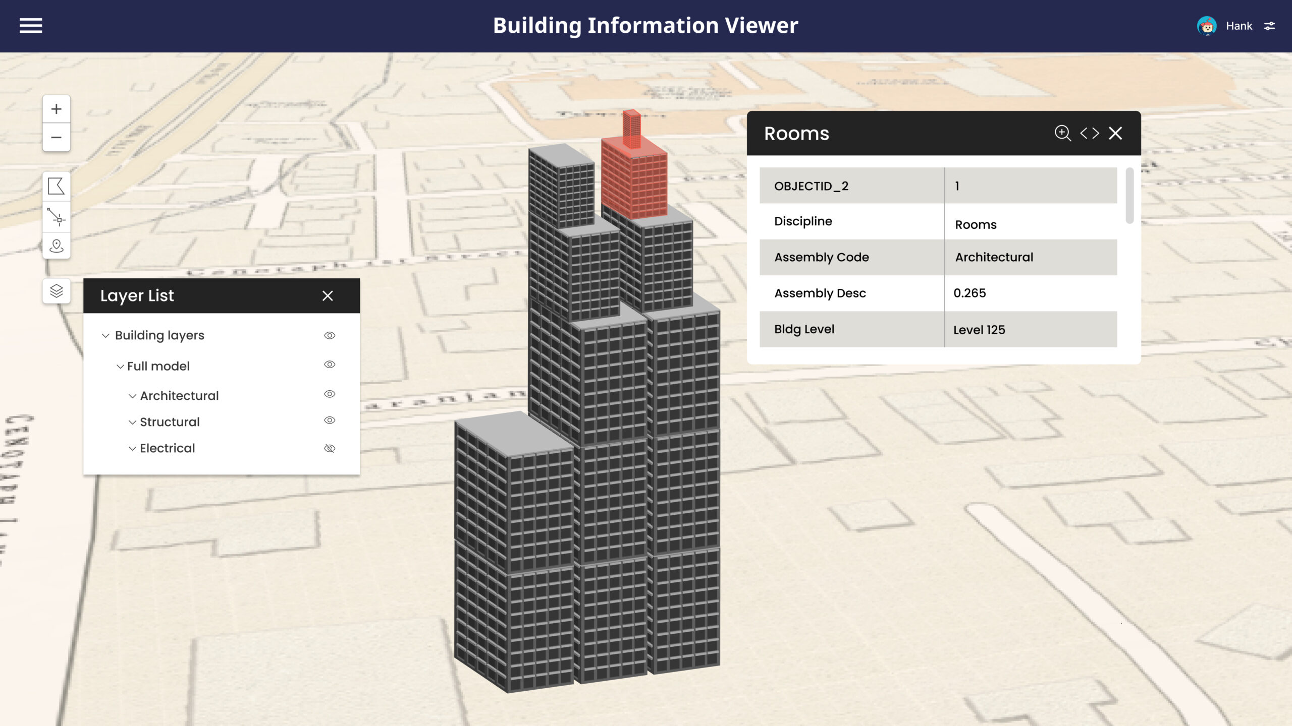
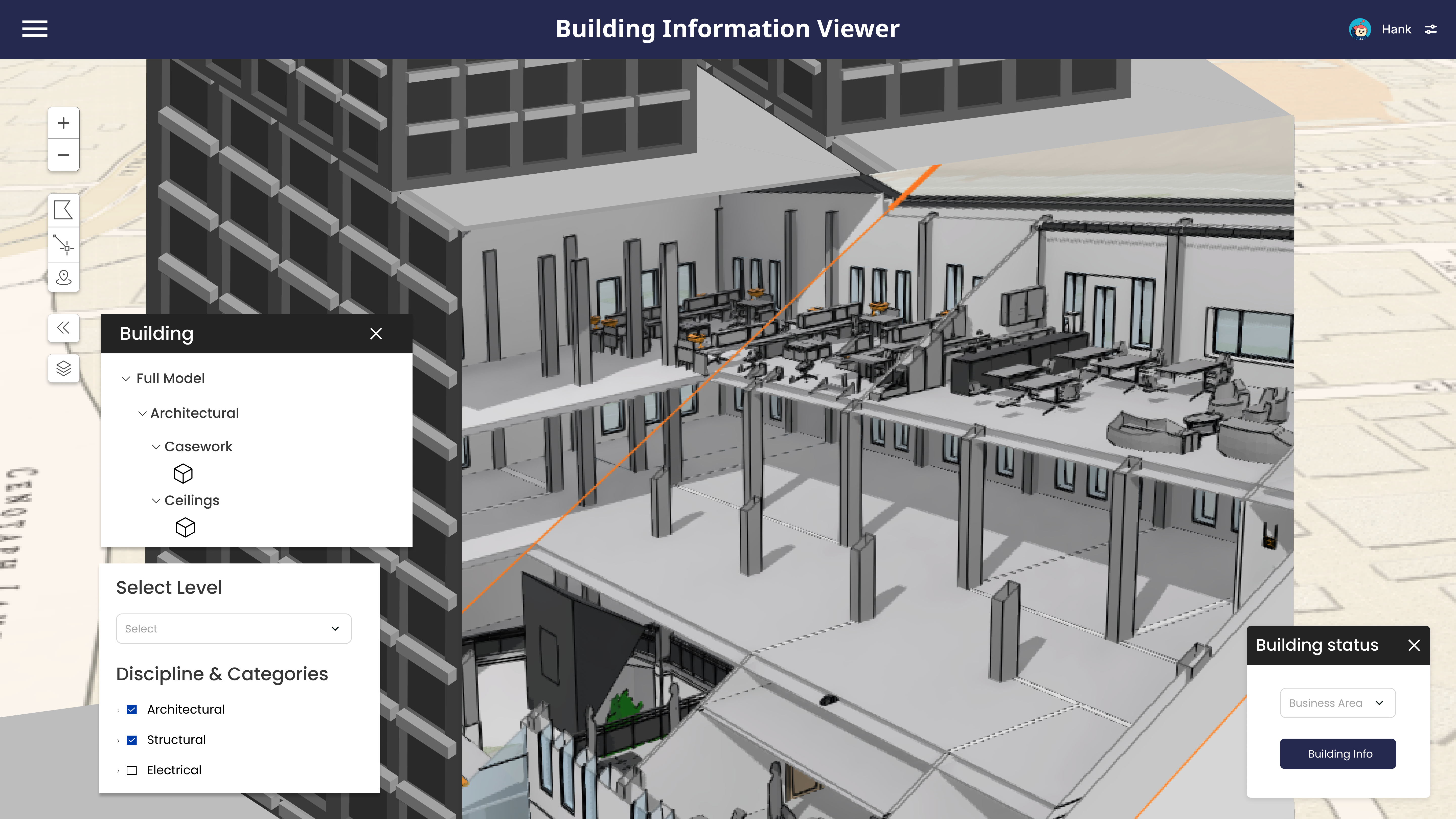
BIM-GIS integration offers numerous benefits, including enhanced visualization by combining 3D models with spatial data for better project understanding. It enables informed decision-making by integrating design and geographic context, ensuring accurate site selection by assessing terrain, risks, and regulations. Optimized design and construction reduce errors and improve project efficiency, while sustainability and regulatory compliance are enhanced through eco-friendly planning. Efficient asset management allows real-time tracking and cost-effective maintenance, while improved infrastructure planning aids in route optimization and maintenance scheduling. Seamless collaboration between architects, engineers, and planners ensures better coordination, while data-driven insights support predictive maintenance and resource optimization, ultimately leading to smarter, more sustainable projects.
Integrating BIM and GIS may seem like a challenging task, but the benefits far outweigh the effort. From improved efficiency and cost savings to enhanced safety and sustainability, this integration is transforming how construction projects are managed. As more professionals recognize the value of BIM-GIS integration, it is quickly becoming an industry standard. Investing in this technology today can lead to smarter, more sustainable, and successful projects in the future.
Nimisha Srivastava is a Pre-Sales Consultant who is enthusiastic about the Geospatial field and has great communication skill. She has an year’s experience in the geospatial industry and is always eager to learn new things.

