Land is one of the most critical assets for governments, institutions, and citizens alike. It defines ownership, drives revenue, influences development, and forms the legal foundation of society.
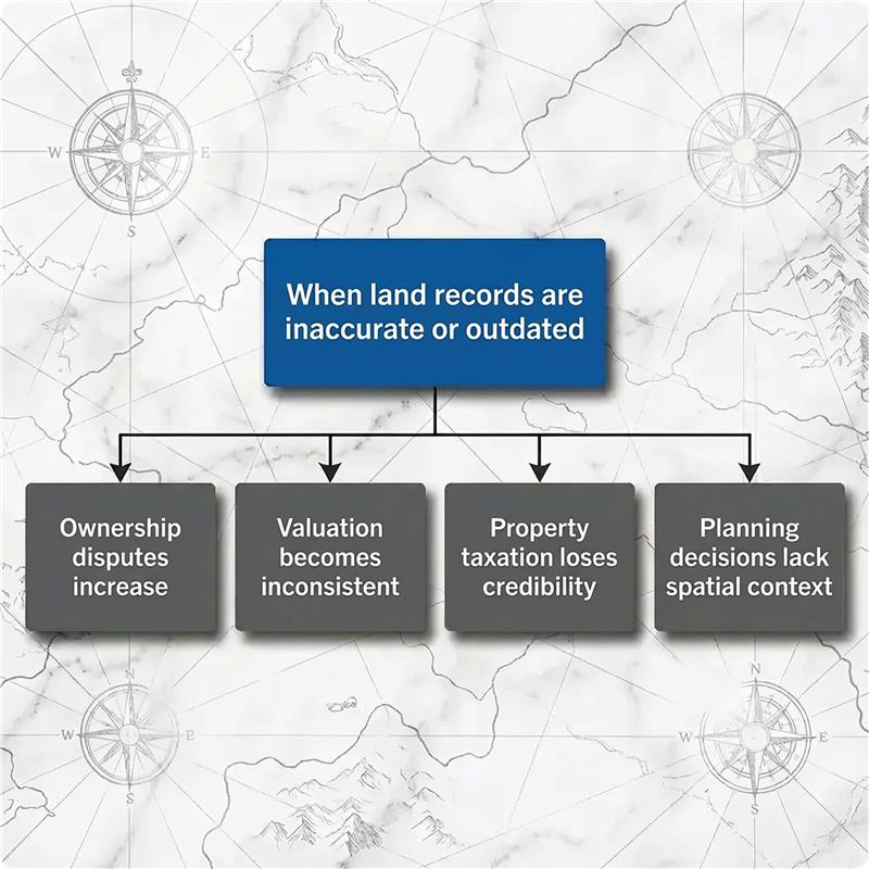
Yet in many regions, land administration still relies on fragmented systems — paper records, disconnected databases, manual surveys, and subjective valuation methods. This fragmentation leads to disputes, revenue loss, delays in service delivery, and a lack of transparency.
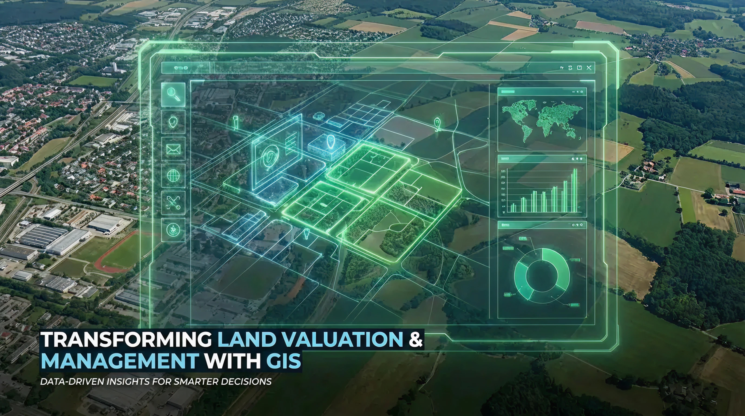
Modern land governance requires a digital, spatially driven approach. This is where GIS-based land valuation and management systems fundamentally change how land information is created, maintained, and used.
Land administration is not just about ownership records or taxation in isolation. It is the combination of location, legal rights, and value.
Accurate surveying and spatial mapping provide the foundation upon which registration, valuation, and taxation depend. GIS brings these elements together by linking every land parcel to its exact location, ownership history, and financial value.
Traditional land systems struggle because they are not spatially connected. A map exists in one department, ownership records in another, and valuation data somewhere else.
A GIS-based approach overcomes this by:
Instead of static records, land information becomes dynamic, searchable, and map-driven.
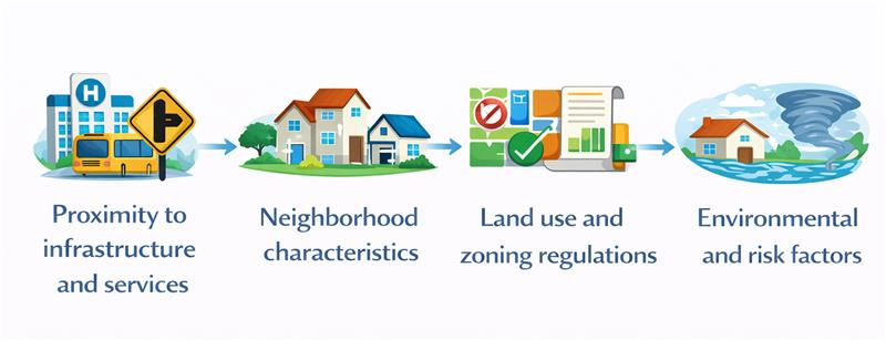
Land value is inherently spatial. Two properties of the same size can differ drastically in value based on:
GIS enables valuation to move from subjective judgment to data-driven analysis by combining spatial and attribute data with market insights. The result is consistent, transparent, and defensible valuations.
Technology alone does not transform land administration — how it is designed, integrated, and implemented matters just as much.
Hexamap helps governments and institutions move from fragmented land records to fully integrated, GIS-driven land valuation and management systems by focusing on both spatial accuracy and operational usability.
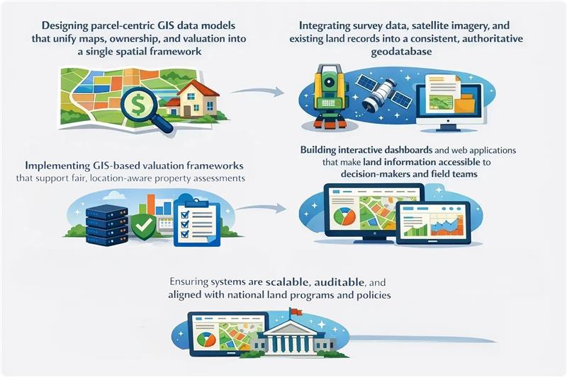
Most importantly, we focus on practical adoption — creating systems that officials can trust, citizens can understand, and institutions can rely on for long-term governance.
When valuation is accurate and spatially linked:
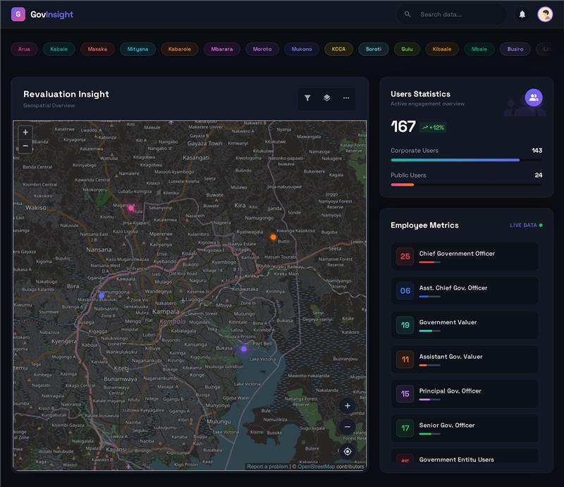
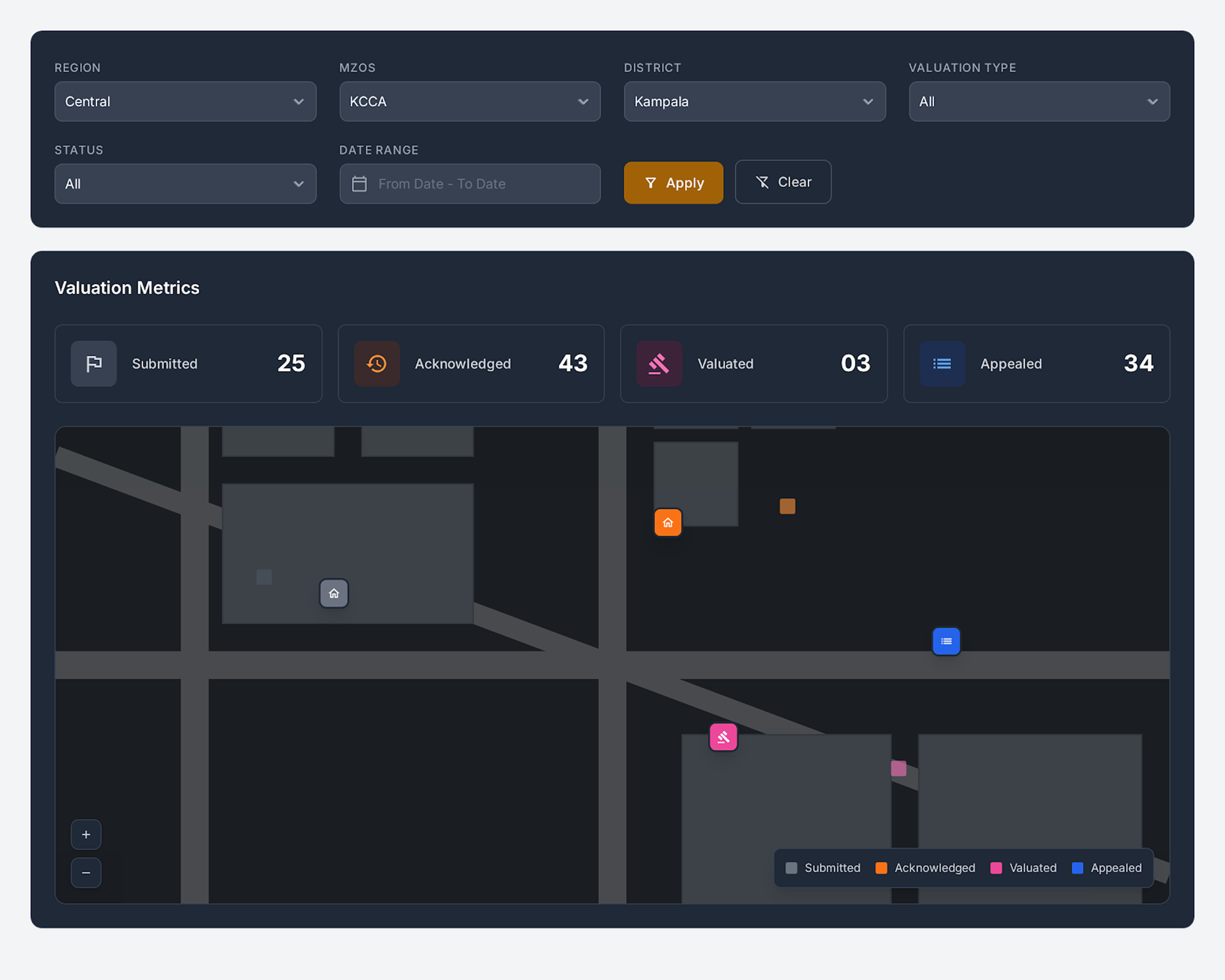
GIS dashboards enable authorities to monitor valuation patterns, taxation recovery, and growth areas — supporting informed financial planning and improved governance.
Most importantly, we focus on practical adoption — creating systems that officials can trust, citizens can understand, and institutions can rely on for long-term governance.
A unified GIS-driven system supports multiple stakeholders without duplication:
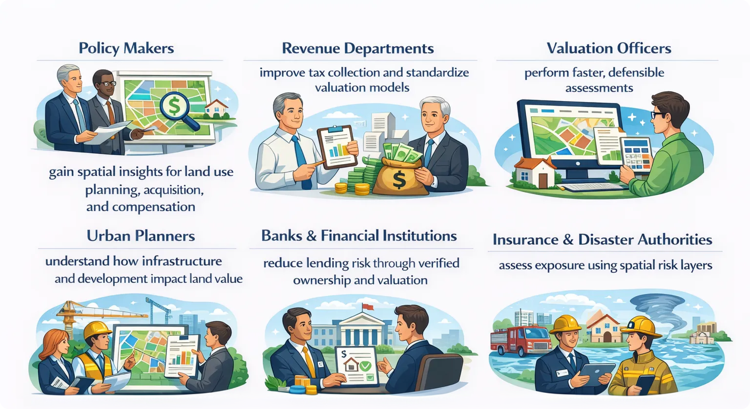
All stakeholders operate on a single, trusted spatial foundation.
GIS-based land valuation and management systems are already delivering measurable impact.
India
GIS-enabled cadastral mapping and digitized land records under national land modernization initiatives have improved transparency, reduced disputes, and accelerated land-related services.
Uganda
A centralized GIS-based land valuation system has streamlined valuation workflows, strengthened legal defensibility, and improved revenue assessment at a national scale.
Qatar
GIS-powered parcel- and apartment-level valuation systems have enabled real-time market insights, transparent transactions, and data-driven policy decisions.
These implementations demonstrate that GIS-based land systems are scalable, reliable, and ready for long-term governance.
Land administration is no longer just about maintaining records — it is about managing land intelligently.
By integrating surveying, mapping, ownership, valuation, and taxation into a single GIS-driven platform, organizations gain:
With the right GIS foundation and implementation approach, land valuation and management evolve from fragmented processes into a strategic decision-support system.
GIS for Land Records: Value Analysis Techniques | Esri India : refer the case studies
Forest-based Classification and Regression in ArcGIS Pro 2.2
Maui County introduces 3D mapping | National Association of Counties
Shawnee County Appraiser’s Office Uses a GIS-Centric Workflow
Telling the Story of Taxes in Alaska | Summer 2017 | ArcUser
How Assessors’ Offices Can Use Dashboards to Aid Decision-Making

