How GIS-Based Early Warning Systems Can Save Lives

Every year, the Indian Himalayan state of Uttarakhand faces the fury of the monsoon. Torrential rains trigger landslides, flash floods, and river overflows, often leading to tragic loss of life, destruction of infrastructure, and displacement of communities. The steep terrain, fragile geology, and rapidly expanding settlements in hazard-prone zones amplify the risks.
This monsoon, Uttarakhand once again witnessed severe flooding in multiple districts, road blockages due to landslides, damaged bridges, and isolated villages cut off from basic services. Emergency response teams struggled with timely rescue due to limited situational awareness and lack of predictive intelligence.
So, the pressing question is: Can we do better?
The answer lies in the power of Geographic Information Systems (GIS).
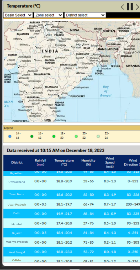
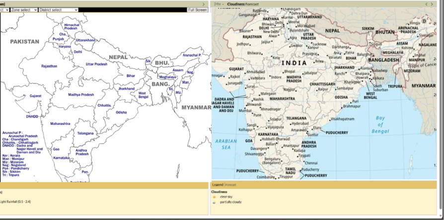
GIS is no longer just a mapping tool – it is a decision-support system that integrates real-time data, predictive models, and spatial analytics to provide actionable insights during natural disasters. Here’s how a GIS-based early warning system could transform disaster management in Uttarakhand:
A GIS-driven early warning system ensures that data is not locked in silos but flows seamlessly between meteorological agencies, disaster management authorities, and citizens.
Uttarakhand’s future resilience depends on:
When implemented at a scale, such a system can shift the disaster management paradigm from reactive relief to proactive risk reduction.
The monsoon disasters in Uttarakhand remind us that nature’s fury cannot be stopped—but with GIS-enabled early warning systems, its impact can be greatly reduced. By predicting risks, planning safe evacuations, and ensuring timely communication, GIS can save lives, protect livelihoods, and strengthen the state’s resilience against climate change-driven extremes.

