Hexamap Solutions has always proved to be Off the Shelf to our clients. As an ESRI Silver partner, it becomes our prime responsibility to give our customers an end-to-end service when it comes to transitioning from one technology to the other advanced technology.
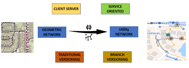
In this blog article we will discuss why we need to move your geometric network to the utility network because the geometric network works upon ArcMap Desktop version which would become obsolete in the upcoming years henceforth the migration is an absolute mandatory process to carried out.
The ArcGIS Enterprise along with ArcGIS Pro shall provide the Network tracing capabilities through the web interface which will help our clients to understand in what way the utility Network topology is associated with its connected Assets. The migration of geometric network to utility network allows the user to integrate GIS System with other External systems like NMS, ADMS, EMS which will evaluate all components of building a business to provide the services.
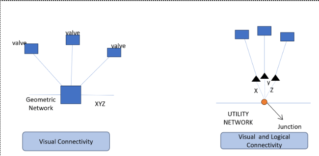
A Geometric Network is a collection of connected edges, junctions, and connection rules, used to depict the behavior of a shared network architecture in the real world. The data sources for the geometric network are geodatabase feature classes.
The geometric coincidence of the features in the feature classes utilized as data sources forms the foundation for the network connectivity. For usage in tracing and flow operations, each geometric network includes a network, which is a set of geodatabase tables that record connection relationships and other details about the features as individual elements.

The primary tool that users utilize to manage utility and telecom networks in ArcGIS is a Utility Network, which offers a complete framework of capability for the modeling of utility systems like electric, gas, water, storm water, wastewater, and telecommunications. Wires, pipelines, valves, zones, devices, and circuits are just a few examples of the many parts that make up our system. It is made to represent all these parts, and it also enables us to support complicated networks and add realistic behavior to the network features we model.
The ArcGIS Utility Network is intended to be the next-generation GIS, with increased capability across huge datasets. We use ArcGIS Enterprise, in conjunction with ArcGIS Pro or ArcGIS Desktop Application, to provide solutions that focus based on our client’s experience and increase communication across the enterprise.


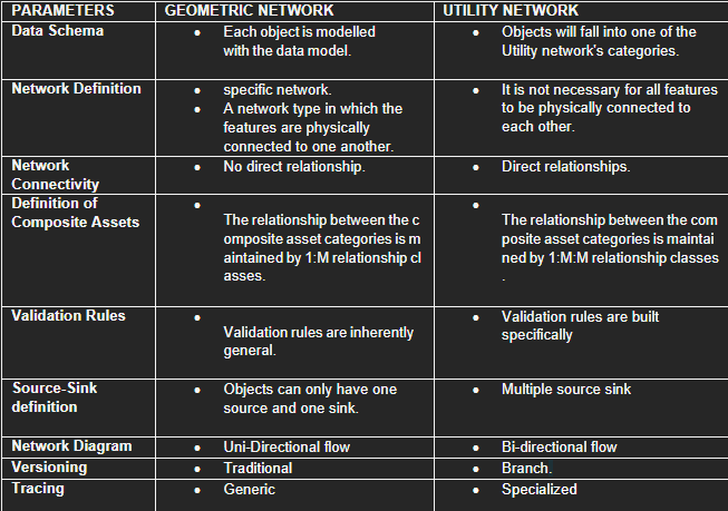
As a GIS service provider, we keep transparency with our clients and create the best for our clients’ requirements. We shall perform data mapping for the conversion of geometric network features to the features used in utility network for our clients. Since it is a tedious and time taking procedure, we use automation procedures so that we can produce faster and accurate results within no time.
The detailed data model mapping is given below.
For Source data preparation and Migration process, contact us
Senthil Kumar V is a seasoned Senior Pre-Sales Consultant with over 8 years of expertise in the geospatial field. He brings a wealth of technical proficiency, specializing in GIS, spatial analysis, and remote sensing. His dedication to innovation and effective communication ensures successful client solutions, making him an invaluable asset to our team.
Nimisha Srivastava is a Pre-Sales Consultant who is enthusiastic about the Geospatial field and has great communication skill. She has an year’s experience in the geospatial industry and is always eager to learn new things.